Bushfires: the most fearsome of natural threats.
In Western Australia, the threat of fire is compounded by a season that stretches from the Southern temperate regions to the Northern tropics. This means it must deal with a summer season that spans November to April, and a dry season that spans June to October.
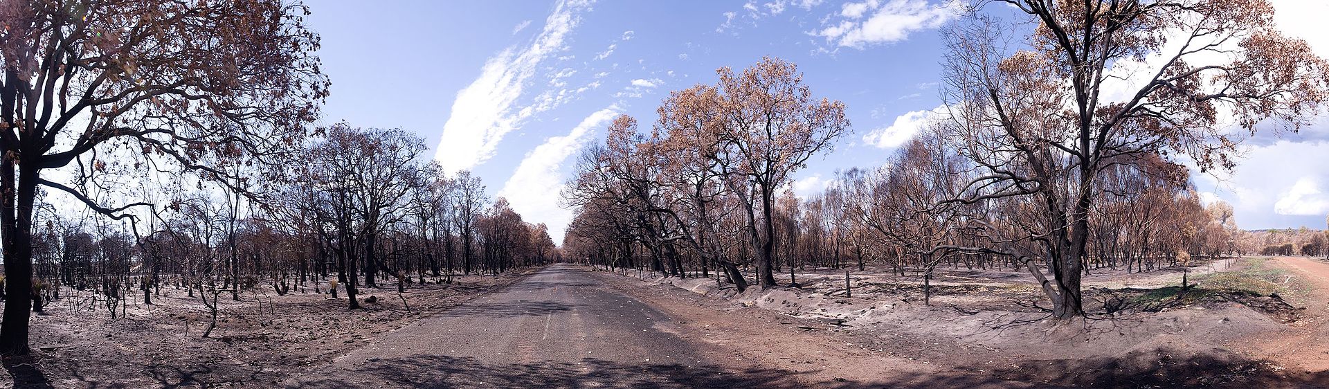
Wagerup/Gnangarra Photographs by Gnangarra
[CC BY 2.5 au], via Wikimedia Commons
The Western Australian Department of Fire and Emergency Services can breathe a sigh of relief only in May.
Following the Keelty report on the bushfires in Perth in 2011, the WA Department of Fire and Emergency Services (DFES) was charged with creating a management framework to identify and mitigate the risk due to bushfire.
A BRMS was listed as one of the top recommendations in the Keelty report into the Kalamunda bushfires, and the application is one of DFES’s top priorities. This project reported initially through Commissioner, and recently through Deputy Commissioner Capability.
In 2015, the Climate Council report warned us of the rising temperatures the lengthening fire seasons. They pointed to North American wildfires creating a competing demand for firefighting aircraft that are contracted to both Northern and Southern hemisphere fire seasons. Small wonder we need so much focus on prevention.
More recently the Ferguson report (culminating from the Yarloop Waroona) fires stated:
“There is a compelling argument that the State needs to readjust expenditure away from fire response and recovery, towards a greater investment in prevention and fuel hazard management.”
While potentially relegated to future governments, prevention is connected to the recommendation that any created Rural Fire Service will:
- “Have responsibilities and powers relating to bushfire prevention, preparedness and response.”
- “Operate collaboratively with DFES, the Department of Parks and Wildlife (DPW), local government and volunteer bush fire brigades.”
This serves to reinforce the importance of the BRMS as Western Australia moves into future fire seasons.
Industry Partnership
Amristar was awarded the contract by DFES in 2014 to implement a solution, based on Pan Software’s RiskCloud platform, and including map-based visualisation & spatial tools to assist in assessing risk factors.
The Bushfire Risk Management System provides a centrally managed and coordinated system that enables a range of stakeholders to manage the risk to land assets associated with bushfires. Stakeholders include Fire and Emergency Services, the Department of Parks and Wildlife and Western Australian local governments.
What does it look like?
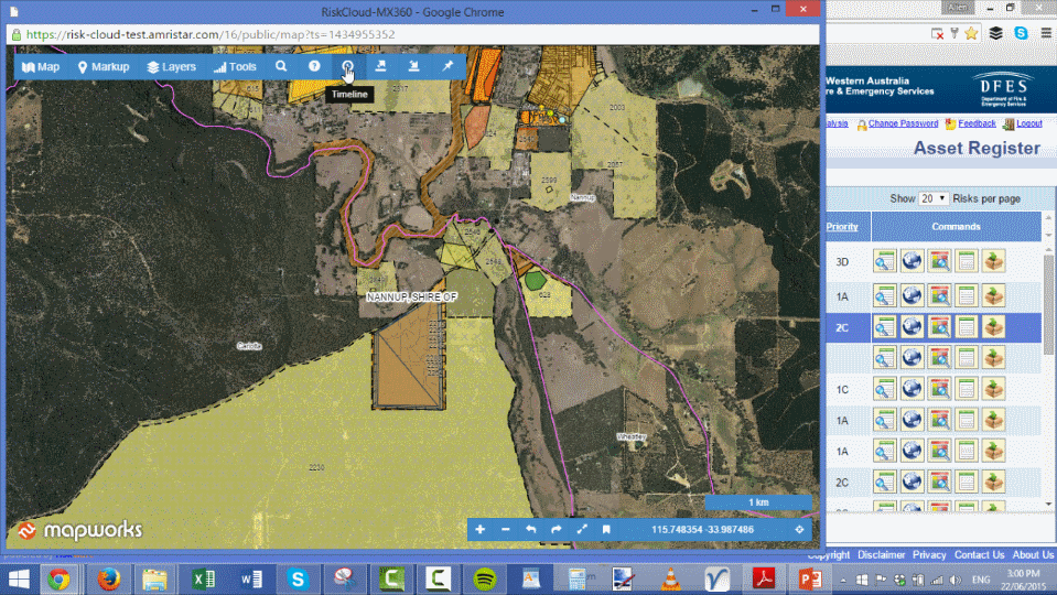
View of the Map and Risk Cloud application in the background showing the features and assets identified
The result is a federated state-wide Bushfire Risk Management System. Its benefits include improvements in the identification of bushfire risk in relation to community assets, and greater capacity to prioritise appropriate mitigation works across the State. The BRMS aims to enhance community safety from bushfire risk but also, importantly, to enable easier integration with collaboration partners and stakeholders.
The solution that was implemented:
- Utilises Pan Software’s RiskCloud platform, a pure cloud-based platform for Enterprise Risk Management which implements the relevant international standards for risk management.
- Integrates online maps utilising WA Government SLIP Enabler base maps & themes, together with DFES asset layers utilising Amristar’s Mapworks product.
- Provides a set of map-based spatial tools to enable easy visualisation of assets including historical views.
- Enables analysis of risk factors associated with vegetation and ground-based factors such as slope.
The role of PAN
PAN Software’s RiskWare/RiskCloud platform is a pure cloud-based platform for Enterprise Risk Management which implements the relevant international ISO accredited standards for risk management. While the platform provided by PAN met the requirements for the risk management aspects of the BRMS, it did not provide any of the GIS requirements or integration.
The role of Mapworks
The key mapping related requirements for the Bushfire Risk Management System were:
- Asset Identification: Provision of a map-based system utilising authoritative maps and imagery enabling stakeholders to identify and mark up assets. Asset identification is particularly important when considering bushfires, noting that the risk assessors need to be able to view structural overlays (roads and related infrastructure such as power/water/etc) combined with detailed aerial photography in order to adequately assess risk in relation to bushfire and bushfire related factors.
- Risk Analysis: Utilising the map-based interface to undertake analysis as part of risk assessments including slope and vegetation analysis performed upon marked up transects (which ensures compliance with AS3959). This assessment again requires the assessor to identify specific areas on the ground in relation to the asset itself and the surrounding vegetation to use as inputs in the risk analysis.
- Planning & Treatment: Enable personnel to gather data for preparation of a Bushfire Risk Management Plan (BRMP) through: assignment of asset criticality; perform asset risk assessment; assigning a treatment to mitigate risk; scheduling a treatment; report on a treatment plan by asset; ongoing monitoring of treatment implementation; report on post treatment; and ensure that competent personnel have been assigned to the task.
This process requires detailed maps including aerial photography and map data such as contours (to determine elevation).
Amristar’s Mapworks cloud platform provided fully HTML5 web-based maps, together with a rich spatial API enabling tight application integration with the RiskWare/RiskCloud platform.
Spatial information and the use of comprehensive, authoritative and accurate maps is essential for undertaking both of the above requirements of the BRMS. Without the spatial enablement provided by the Mapworks platform, meeting these requirements would not have been possible.
The Mapworks platform enabled:
- Online base maps maps utilising WA Government SLIP Enabler base maps & themes, together with DFES asset layers.
- GIS spatial database feature CRUD (create/read/update/deleted) to enable asset identification and maintenance within the BRMS.
- Fully versioned spatial layers to provide full audit histories for spatial information.
- Simple geoanalytics (buffer/intersect/distance) for DFES BRMS data together with other layers to enable risk analysis based upon spatially factors.
- Web based REST API based integration with the RiskWare/RiskCloud platform.
- Full security integration.
The solution was completed in 2015 with the intention by DFES to roll out the BRMS state-wide in Western Australia. The BRMS was designed as a tenure-blind solution to facilitate broad engagement of stakeholders at the state and local government levels, including Fire and Emergency Services, the Department of Parks and Wildlife and Western Australian local government.
The Department of Fire and Emergency Services plans to use the system as part of its long term plan for managing and mitigating the risks due to bushfires in Western Australia. The BRMS Project Manager Giles Debrito (supported by Chief Supt Rob Cox) provided a testimonial from DFES in 2016 which said of the BRMS:
“DFES anticipates that as the BRMP process is extended throughout the State, and adequate funding is provided to carry out the necessary mitigation works, BRMS will become the primary tool for prioritising and managing the State’s bushfire risk.”
Factors ensuring the solutions longevity and sustainability include:
- improvements in capacity, efficacy and efficiency in areas of business such as risk identification and prioritisation of mitigation works.
- The process and methodology which enhances community safety from bushfire risk, and also enables easier integration with collaboration partners and stakeholders.
- The selection of a SaaS platform which brings the applicability of the solution to other states and territories.
The resulting integrated Bushfire Risk Management System provides DFES with a ISO accredited risk managemen system with a range of spatially enabled capabilities specific to bushfire risk on a platform that enables collaboration on the Internet across the vast state of Western Australia.
Register for Mapworks at mapworks.io